@adrinux @ccferrie @d_mathieson @clickhere @DublinCommuters @OisinOConnor Google Maps is indeed rubbish for cycling; one reason is that its Street View is only for carbrain roads, and doesn't work, for instance when the cycling path goes across the interchange at the Red Cow on the M50. If it had, I might have seen which was the right exit #GoogleMaps #Cycling
If they could send a cyclist along cycle paths wearing a GoPro or other camera, they could have a different colour StreetView prompt
#GoogleMaps
And is that a set of steps I'd have to carry my bike down on the route they're sending me to? #GoogleMaps doesn't allow me to use Street View on the bicycle path there, so I can't see, but it looks suspiciously like that, which would make the route impossible for me
@d_mathieson @ccferrie @clickhere @DublinCommuters @OisinOConnor
#RedCow
#GoogleMaps #Ireland #PublicSafety
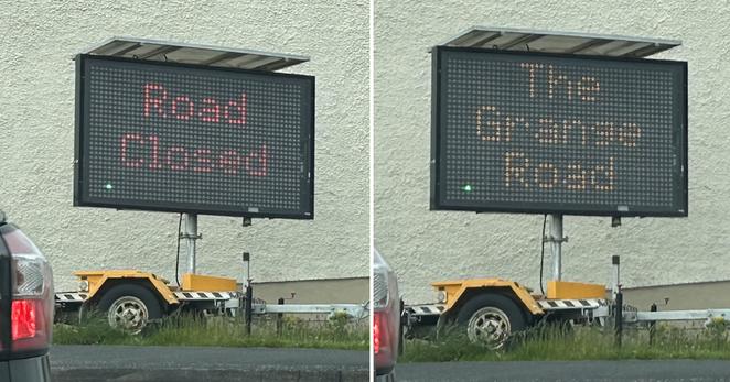
'Donegal County Council has been asked to contact Google Maps again to try and fix the incorrect naming of the Old Glencar Road in Letterkenny.'
AGAIN.

https://news.itsfoss.com/comaps-launch/
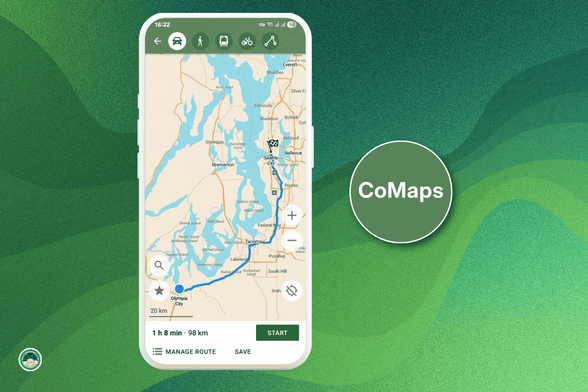
A new privacy first, offline Map alternative is set to compete directly with Google, introducing CoMaps!!

I will never again post a review on Google Maps. One review was flagged as ‘defamation’.
They couldn’t tell me what was defamatory. They asked for example for documents proving that I was there (which was 2-3 years ago, a café where I paid cash).
I wrote to the owner of the café, who apologized saying that my review was accidentally flagged and they wanted to flag another. And that they would take care.
I sent Google a screenshot of that mail. They asked for a court order or getting a lawyer.
WHAT THE HECK?
I deleted all my reviews.
It's FOSS article about CoMaps
CoMaps article: https://www.comaps.app/news/2025-07-04/ITS-FOSS-NEWS-Look-Google-We-Have-This-New-Private-Offline-Alternative-Now/
It's FOSS article: https://news.itsfoss.com/comaps-launch/
“With CoMaps, you can download entire regions before you begin a trip for easy navigation in places without an internet connection or mobile network connectivity.”
“The user interface is clean and intuitive. You won’t need a manual to figure it out."
"Moreover, privacy is baked into the app."
"The map style itself is another highlight; it feels fresh, modern, and thoughtfully designed"
P.S. I like it too. It's easy to use, reliable enough, and I don't need to fear that “someone” is keeping its eyes on me 

Bei vielen von uns wird für die #Navigation wohl eine der beliebten Navi-Apps wie #AppleMaps oder #GoogleMaps zum Einsatz kommen. Dass es gerade auch im Hinblick auf quelloffene und community-basierte Anwendungen anders gehen kann, beweist die neue #Navi-#App @CoMaps, die seit Ende des letzten Monats im deutschen #AppStore zum #Download bereit steht und komplett kostenlos genutzt werden kann.
Alle Infos: https://www.appgefahren.de/?p=382058
Can anyone with a regular and recent #stockROM #Android phone confirm if they were able to uninstall (not deactivate!) pre-installed apps like #Chrome, #Youtube, #GoogleMaps, #GoogleDrive, #GooglePhotos, or #Gmail ?
4. (Progressive) #Webapps.
While iOS has blocked this feature for years, locking developers to their pricey and walled #AppStore, on Android every Website in your browser can be used like a native app.
#Meta ironically blocks this aggressively, locking Video Playback and more to their App™. Other apps like #GoogleMaps, #TikTok or #Shitter annoy you with popups, but offer often reduced versions like this.
Webapps are WAY more isolated, cannot execute random code and more.
7/8
(This toot is half-joking. Maybe it‘s an issue with the app I was using… but for a project that maps every tiny footpath and trash bin where I live I found it less than ideal as a replacement for #GoogleMaps or #AppleMaps)
#OpenStreetMap for #Portland is so extremely outdated that I discovered there used to be a restaurant called Daruma Sushi that closed in 2019 in the same space that is currently hosting Feral. Orange & Blossom was missing entirely. I tried to update both, but since #OrganicMaps didn’t let me log in, I’m not sure if my updates will sit in a queue somewhere…
In any case, #OSM is far from being a reliable #GoogleMaps replacement, unless you somehow already know exactly where you’re going
„#GoogleMaps hat vornehmlich die israelischen Siedlungen eingezeichnet“
„Das #Westjordanland ist übersät mit illegalen israelischen Siedlungen, die Palästinenser nicht betreten dürfen. Es gibt auch Zufahrtsstraßen zu den Siedlungen, die eigentlich auf palästinensischem Gebiet sind, die Palästinenser aber nicht befahren dürfen.
Die Besatzung ist ein fortlaufender Prozess. Die Mauer wird jeden Tag weitergebaut. Neue Siedlungen entstehen, andere werden ausgeweitet. Die Landschaft ändert sich täglich. Straßen und Orte werden umbenannt, wo du gestern noch langfahren konntest, ist heute eine Schranke.
[…]
Google Maps schlägt dir Straßen vor, die du als Palästinenserin in #Palästina nicht befahren kannst. Die App setzt also quasi voraus, dass die Leute, die sich dort bewegen, nicht die Leute sind, die eigentlich dort leben und deren Land das ist.“
https://perspective-daily.de/article/3755-dieses-interview-wird-dein-bild-von-palaestina-veraendern/
Just noticed that #Google finally got around to obscuring the #StreetView of my house on Google Maps after multiple requests.
Don't know exactly how long this took but it took more than a couple of days which is suggested in some articles about the process.
I've made the request multiple times over several years but haven't checked on the last those requests for at least a year. Stopped checking because nothing was done after a week so when I checked on the earlier requests.
If you'd like to do this for your house, there are many articles telling you how to do it. This is just one of them:
https://lifehacker.com/tech/how-to-blur-your-house-on-google-maps
How to Research and Plan a Vacation, Right on Your Phone - Google Maps and Apple’s Maps app offer location-based directories and other tools for fin... - https://www.nytimes.com/2025/06/04/technology/personaltech/plan-vacation-google-maps-apple.html #android(operatingsystem) #computersandtheinternet #ios(operatingsystem) #contenttype:service #mobileapplications #travelandvacations #smartphones #googlemaps #appleinc
How to Research and Plan a Vacation, Right on Your Phone - Google Maps and Apple’s Maps app offer location-based directories and other tools for fin... - https://www.nytimes.com/2025/06/04/technology/personaltech/how-to-research-and-plan-a-vacation-right-on-your-phone.html #android(operatingsystem) #computersandtheinternet #ios(operatingsystem) #contenttype:service #mobileapplications #travelandvacations #smartphones #googlemaps #appleinc
@fluepke +9001%
#NSAbook is worse than #GoogleMaps!
- Also getting a static website made with these things costs like €500 at most and maybe €10 p.m. for upkeep at grossly inflates rates.
People don't want much so even a WordPress-style CMS is overkill.
- But even a SquareSpace/Wix/whatever... site is better than #StasiBook!
Seeing lots of talk these days about Google Maps being fucked, was it such a good idea to leave so much of the World's traffic infrastructure in the hands of American Oligarchs?
This is why we're never having 'flying cars', not with Capitalism.
https://www.europesays.com/2118695/ Google Maps zeigt falsche Sperrungen: Fast alle Bundesländer betroffen | News #AutobahnA1 #AutobahnA2 #AutobahnA40 #AutobahnA45 #AutobahnA66 #autobahnen #autonavigation #Bayern #deutschland #germany #GoogleMaps #hessen #Kartendienste #Nachrichten #NordrheinWestfalen #texttospeech #Verkehr
Kümmere mich eigentlich lieber um die Aktualität von #OpenStreetMap, aber gelegentlich muss ich dann doch auch bei #GoogleMaps korrigierend eingreifen. Damit lässt sich der Autoverkehr normalerweise hervorragend lenken
Sobald Google Maps eine Straße z.B. als gesperrt für den Kraftverkehr anerkennt, verschwindet dieser von jetzt auf gleich fast komplett. Die extrem hohe Quote der Menschen, die einfach nach Navi fahren, hatte mich anfangs doch etwas überrascht.

