Ich hab gerade mal die #Navigation von #geovelo auf mir bekannten Strecken getestet, an denen andere Navi-Apps oft scheitern:
Respekt, ziemlich gute Routen-Wahl.
Ich hab gerade mal die #Navigation von #geovelo auf mir bekannten Strecken getestet, an denen andere Navi-Apps oft scheitern:
Respekt, ziemlich gute Routen-Wahl.

La carte de l’Empire britannique dressée par Walter Crane en 1886 est référencée dans l’Atlas du Québec en Amérique et dans le monde
https://monde.ccdmd.qc.ca/ressource/?id=137859
#projection #Mercator #illustrations #navigation #statistiques #populations #superficies #commerce #empire #britannique #UK #monde #carte #maps #cartographie #cartographie
Image : David Rumsey Historical Map Collection CC BY-NC-SA 3.0
DIY Navigation System Floats this Boat - [Tom] has taken a DIY approach to smart sailing with a Raspberry Pi as the back en... - https://hackaday.com/2025/07/10/diy-navigation-system-floats-this-boat/ #transportationhacks #navigation #navdesk #upcycle #boat
Neuer Artikel auf iPhone-Blog.ch veröffentlicht:
App «WristTopo» bringt Wanderrouten auf die Apple Watch
Meist greife ich zur Coros Vertix 2 wenn es um ernsthafte Touren geht. Einerseits wegen der hervorragenden Batterielaufzeit und auch, weil ich GPX-Daten auf die Uhr ziehen und diese für die Navigation nutzen kann. Wer stur mit der Apple W
Artikel lesen: https://www.iphone-blog.ch/2025/07/10/app-wristtopo-bringt-wanderrouten-auf-die-apple-watch/
Analyse des cartes historiques des Pieds-Noirs et des Gros-Ventres
Par Ted Binnema, François Lanoë et Heinz W. Pyszczyk
https://ualbertapress.ca/9781772127997/cartographic-poetry/
#Autochtones #Canada #Prairies #UAP #PiedsNoirs #GrosVentres #Amérique #carte #cartrographie #maps #Cartography #anthropologie #paysages #géographie #navigation
@mhedney
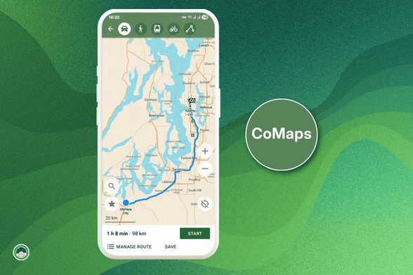
It's FOSS article about CoMaps
CoMaps article: https://www.comaps.app/news/2025-07-04/ITS-FOSS-NEWS-Look-Google-We-Have-This-New-Private-Offline-Alternative-Now/
It's FOSS article: https://news.itsfoss.com/comaps-launch/
“CoMaps, you can download entire regions before you begin a trip for easy navigation in places without an internet connection or mobile network connectivity.”
“The user interface is clean and intuitive. You won’t need a manual to figure it out."
"Moreover, privacy is baked into the app."
"The map style itself is another highlight; it feels fresh, modern, and thoughtfully designed"
P.S. I like it too. It's easy to use, reliable enough, and I don't need to fear that “someone” is keeping its eyes on me 
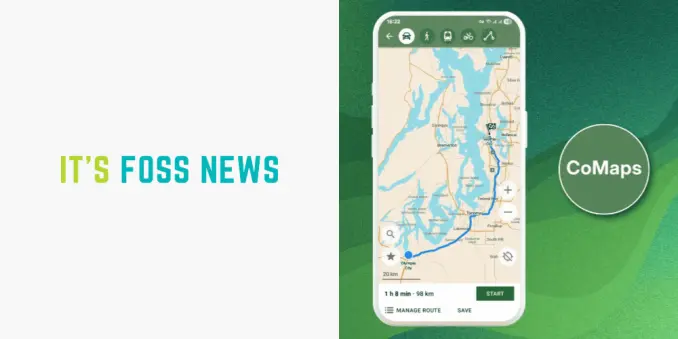
Discover CoMaps, the new open-source, privacy-focused navigation app! Offline maps, no tracking, and a clean UI. Available now on Android & iOS. #Privacy #OpenSource #Navigation https://dub.sh/Xt6k1rt
From: blenderdumbass . org
Paps needs to walk from his room to a car, wait for you, the player to sit with him into said car, and then drive you across a town to a completely different location. Seamlessly.
Read or listen: https://blenderdumbass.org/articles/path_finding_in_upbge_for_dani_s_race
Bei vielen von uns wird für die #Navigation wohl eine der beliebten Navi-Apps wie #AppleMaps oder #GoogleMaps zum Einsatz kommen. Dass es gerade auch im Hinblick auf quelloffene und community-basierte Anwendungen anders gehen kann, beweist die neue #Navi-#App @CoMaps, die seit Ende des letzten Monats im deutschen #AppStore zum #Download bereit steht und komplett kostenlos genutzt werden kann.
Alle Infos: https://www.appgefahren.de/?p=382058
New paper out that I helped a little bit with: "A Demonstration of Interstellar Navigation Using New Horizons", where NSF NOIR Lab's Tod Lauer uses New Horizons images of the parallax Proxima Centauri and Wolf 359 (of Star Trek fame) to figure out the absolute position of New Horizons in near-interstellar space.
It's a very international collaboration, with participation from quite a few small-telescope observers in South America and Australia, and dedicated to the memory of a master Polynesian navigator who inspired some of the thought process. And Brian May too, because he's a friend of the mission.
My little role was in helping to analyze the pointing uncertainty in both the New Horizons and ground based data.

1/ Wie hat man ab dem 13. Jh. mit den Sternen navigiert? Hierzu benutzte man z. B. den #Jakobsstab. Damit konnte man den eigenen #Breitengrad auf der Erde bestimmen. Ein entsprechendes Experiment ist im Technikmuseum in #Berlin aufgebaut. Im Hintergrund sind #Sterne zum Anpeilen. #Navigation
From: blenderdumbass . org
Paps needs to walk from his room to a car, wait for you, the player to sit with him into said car, and then drive you across a town to a completely different location. Seamlessly.
Read or listen: https://blenderdumbass.org/articles/path_finding_in_upbge_for_dani_s_race
Any of you Map/Chart/Hacker folks know if anyone has cracked the encryption on the charts that go through o-charts.org?
I am asking as someone who has paid, but they are so utterly painful to use in their stupid encrypted format, especially if you ever dare to change anything about your hardware, that they are essentially unusable. People use them on a boat, people drop their Chromebooks into a bilge full of horror - Shit like this shouldn't be wholly dependent on a systemid!
Video: CoMaps – Freie Karten-App für Android-Geräte
Ich bin immer auf der Suche nach Freien Alternativen zu Google-Diensten, besonders wenn es um so zentrale Funktionen wie Karten und Navigation geht. Kürzlich bin ich auf die App CoMaps gestoßen, die ich euch heute vorstellen möchte.
#Maps #Karten #Navigation #Linux
https://gnulinux.ch/comaps-freie-karten-app-fuer-android-geraete
"Each spring, billions of Bogong moths (Agrotis infusa) migrate hundreds of kilometres south to the Australian Alps, guided by the austral night sky. The discovery that they can find their way using only the stars — reported in an 18 June Nature paper — makes this moth the first invertebrate to be observed using celestial navigation for long-distance journeys."
Eight times in 3½ hours a boat crashed into me while I was tied up along the shore.
I have just moved the boat forward, leap-frogging two boats.
And in the process I myself hit 2 boats — inevitable, unfortunately, but I was unwilling to continue being crashed into by people for whom the wind is somehow a surprise.
Six boats have crashed into me in the past 3 hours, scraping and bouncing all the way down the length of the boat. The wind is too strong for occasional- and hire-boaters but it doesn't stop them, so they get blown into me as they clear the trees.
I want to move but the strong wind also means I cannot move the boat. There are 2 boats immediately ahead of me and I could never clear them.
"A GPS Blackout Would Shut Down the World" by @WIRED - Article examines dangers of dependency on #GPS for #PNT ( #positioning #navigation #timing ) without adequate backup systems in case of failure. https://www.wired.com/story/youre-not-ready-for-a-gps-blackout/ #GNSS #space #tech
A #GPS #Blackout Would Shut Down the World
GPS #jamming and #spoofing #attacks are on the rise. If the global #navigation system the US relies on were to go down entirely, it would send the world into unprecedented chaos.
https://www.wired.com/story/youre-not-ready-for-a-gps-blackout/
From: blenderdumbass . org
Paps needs to walk from his room to a car, wait for you, the player to sit with him into said car, and then drive you across a town to a completely different location. Seamlessly.
Read or listen: https://blenderdumbass.org/articles/path_finding_in_upbge_for_dani_s_race