shakedown.social is one of the many independent Mastodon servers you can use to participate in the fediverse.
A community for live music fans with roots in the jam scene. Shakedown Social is run by a team of volunteers (led by @clifff and @sethadam1) and funded by donations.

Administered by:

Server stats:

268
active users

#opendata

9 posts8 participants4 posts today

Climate denial by erasure

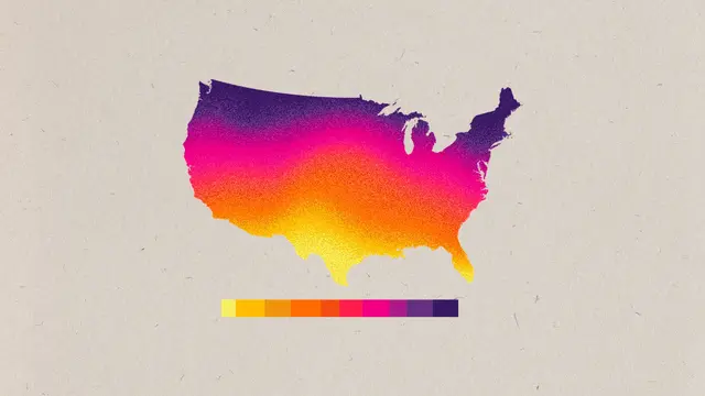
Good point: When the #Trump admin takes down #climate #data, lays off climate scientists, cuts climate research funding, and terminates climate grants, that "isn’t climate denial in the traditional sense. The days of loudly debating the science have mostly given way to a campaign to withhold the raw information itself. 'I don’t know if we’re living in climate denial anymore,' said #LeahAronowsky, a science historian at Columbia Climate School. 'We have this new front of denial by erasure.' "
laist.com/news/climate-environ

Colorful gradient map of the United States showing climate variation across regions, with a horizontal color scale beneath indicating temperature or intensity levels.
LAist · Why the federal government is making climate data disappearBy Grist

#Cejourla en 2017, les #Archivesnationales adoptent le principe de la réutilisation libre et gratuite des informations publiques produites ou reçues.
Au quotidien, il faut toujours et sans cesse prendre son bâton de pèlerin, faire de la pédagogie, expliquer et combattre ✊ 💪🏽 les vieilles habitudes de mettre du DR et du © sans réfléchir...

Mais c'est quand même super cool d'avoir cette étendue des possibles...

🗺️ Map showing Land Cover of South America (2020)
From the vast Amazon 🌳 to the Andes 🏔️ and farmlands 🌾 — this map reveals how land is used across the continent.

📊 Data:
@mapbiomas
@gebcobathymetry

#GIS#GEBCO#QGIS

There’s a new #OpenStreetMap website feature related to #Wikidata!

When viewing objects in OSM that have a Wikidata tag, you can now click the Wikidata icon to turn the opaque QID values into human-readable info (plus a link to Wikipedia if any).

github.com/openstreetmap/opens

This integrates the functionality that @ZeLonewolf’s browser extension provided directly into the OSM website.

h/t: @mxn

#OpenData #LinkedOpenData @wikidata

#PaulKrugman on the cutbacks at #NOAA and National Weather Service (#NWS).
paulkrugman.substack.com/p/for

"Weather forecasting and the research that supports it…are what economists call “public goods.” That is, they’re things provided by the government because they’re valuable to everyone but can’t easily be monetized, because there’s no good way to limit access to paying customers. I say no 𝘨𝘰𝘰𝘥 way advisedly. Republicans have long sought to restrict access to National Weather Service data to private companies like AccuWeather, which in turn would provide forecasts only to paying customers. And they may succeed. But this would be obvious profiteering, creating artificial middlemen for access to information generated at taxpayer expense. And it would at best support forecasting, not the research that makes forecasting better."

h/t @lschiff

Paul Krugman · For MAGA, Ignorance is StrengthBy Paul Krugman

"Data manipulation within the US Federal Government."
thelancet.com/journals/lancet/

"A US Department of Veterans Affairs dataset compiling veteran health-care use in 2021 was quietly amended on March 5, 2025. A column titled #gender was renamed #sex, and the words were also switched in the dataset title and description…Before March 5, the dataset had not been modified since it was published in 2022. As of May 1, the dataset change log, in which modifications should be tracked, is empty. The switch from gender to sex also occurred in other public health datasets, including US Centers for Disease Control and Prevention (#CDC) datasets tracking global adult tobacco consumption, stroke mortality data from 2015 to 2017, and a survey of nutrition, physical activity, and obesity…The agencies involved have not issued any statements confirming or explaining these changes."

PS: If these agencies think the label change ("gender" → "sex") is significant, then they are deliberately misrepresenting the data. If they think the terms are synonymous, then why are they bothering?

Wieviele Parkplätze für Autos gibt es in :wien: Wien eigentlich? Und wo sind sie? Niemand weiß es! Obwohl das essentielle Planungsgrundlagen sind.

Im 7. Bezirk lassen wir eine solche Parkraumbilanz seit 2012 erheben, mit der letzten Aktualisierung Ende 2024 [1].

Mit dem 5. und 8. Bezirk folgen jetzt weitere Bezirke, welche eine solche Bilanz [2][3] erstellen haben lassen und heuer inkl. Kosten auch auf @datagvat veröffentlicht wurden.

[1]: data.gv.at/katalog/dataset/137
[2]: data.gv.at/katalog/dataset/c1d
[3]: digital.wienbibliothek.at/wbru

Does anyone know where I can find data files representing the Paris light rail network (métro and RER) as a graph in the mathematical sense, i.e. a list of nodes with one node per station (with its name), along with a list of edges? I haven't found anything like this on the Open Data web sites of the RATP or Île-de-France Mobilités: it looks like they have data on lines and stops, but not a graph of stations. Maybe I'm looking in the wrong places? @Alon @bovine3dom #OpenData #Paris

:crt_w_green_lines: Hackathon: Data Under Threat / Data Rescueing (Aug 7) in #München
The LMU Open Science Center (@lmu_osc) runs a hackathon to support the #SciOp #SafeguardingResearch initiative: Rescuing research data that is deleted by the Trump administration.

Bonus: @lavaeolus will give an ignition talk!

📅 Thursday, 2025-08-07, 16 – 19 (only in-person)
👉 Details and signup: github.com/lmu-osc/safeguar.de

Become a data rescuer by turning your own laptop into a Research Data Rescue Node, scraping at-risk data sets, and breathing new life into your old HDD as part of a global, decentralised network.

#LMUMünchen #OpenScience #OpenData #DataRescue
CC @SafeguardingResearch @bitsUndBaeumeAuxMuc

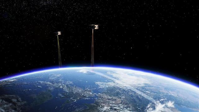
"Landen en bedrijven houden zelf bij hoeveel CO2 en andere broeikasgassen ze uitstoten. De Tango-satellieten controleren in hoeverre die opgegeven cijfers kloppen."

En het mooiste: de gegevens van Tango zijn vrij en gratis beschikbaar!
#Milieu #BroeiKasGas #OpenData

nos.nl/artikel/2574259-nederla

nos.nlNederlandse CO2-meetsatellieten gaan landen 'op de vingers kijken'Landen mogen hun eigen uitstoot van CO2 bijhouden. Satellieten kunnen vanuit de ruimte bijhouden of de cijfers kloppen.