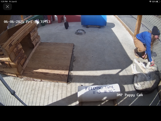
The Denali Puppy Camera is back in operation for the 2025 season (Denali National Park and Preserve). Image credit National Park Service and Alaska Geographic. Learn more at #nps #nationalparks #interpretation #alaska #publiclands #photography #landscapephotography #denali #sleddog #sleddogs #travel #mushing #puppycam and https://www.nps.gov/dena/index.htm and https://www.nps.gov/dena/learn/photosmultimedia/webcams-pups.htm#D642E93C-A9A0-40D8-ADA6-78289589ED65 and https://www.nps.gov/dena/learn/photosmultimedia/webcams.htm #sca (Student Conservation Association)
Recent searches
Search options
#interpretation
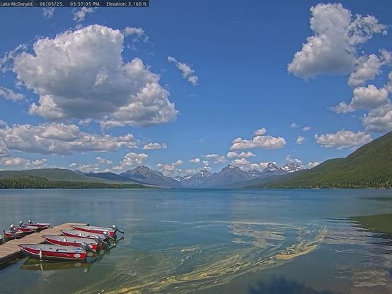
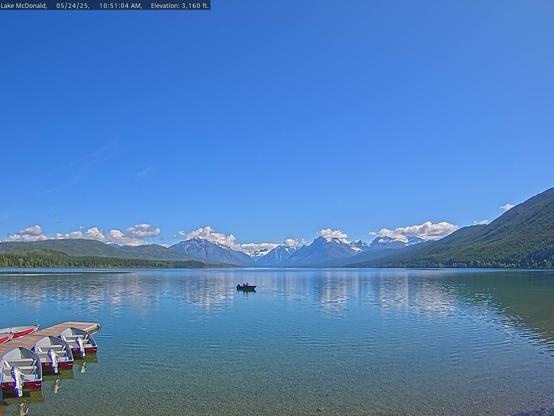
Lake McDonald in Glacier National Park. This view from yesterday afternoon shows what appears to be “an abundance of pollen” on the lake’s surface in the foreground. For more information https://www.nps.gov/glac/index.htm and https://www.nps.gov/glac/learn/nature/treesandshrubs.htm and http://formontana.net/pollen.html and #glacier #interpretation #nps #nationalparks #publiclands #landscapephotography #photography #montana Image credit National Park Service and the Glacier National Park Conservancy #mtwx #spring #snow #lakemcdonald #clouds #trees #mountains #lake #colors #boat #pollen
New Dungeness Light Station today. For those interested in visiting, general location reference points include Washington (USA), British Columbia (Canada), Salish Sea, Puget Sound, and Dungeness National Wildlife Refuge. Image credit NDLSA. Learn more at #USFWS #wildliferefuge #lighthouse #landscapephotography #photography #interpretation #publiclands and https://newdungenesslighthouse.com and https://www.fws.gov/refuge/dungeness #washington #history #nationalhistoricsite
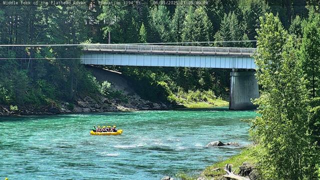
Glacier National Park today (Middle Fork of the Flathead River at West Glacier). For more information https://www.nps.gov/glac/index.htm and #glacier #interpretation #nps #nationalparks #publiclands #landscapephotography #photography #montana Image credit National Park Service and the Glacier National Park Conservancy #mtwx #spring #trees #river #colors #travel
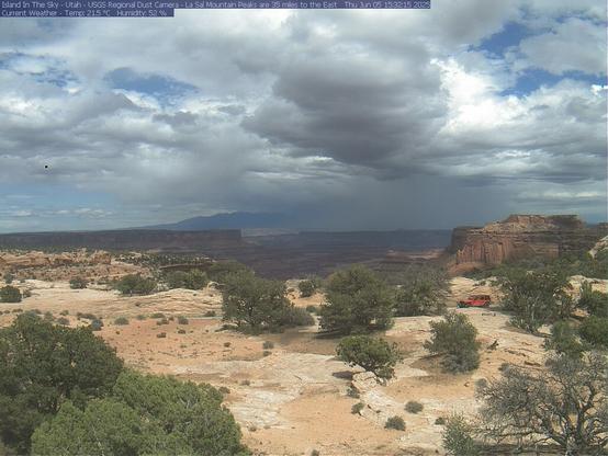
Canyonlands National Park today. The Canyonlands National Park camera is one of several Regional Dust and Environmental Observation Cameras in the desert southwest. Learn more at https://www.nps.gov/cany/index.htm and https://gec.cr.usgs.gov/gecsc/regwebcams/index.shtml and #usgs #geology #airquality #canyonlands #utah #utwx Image credit USGS/USGS American Drylands Project
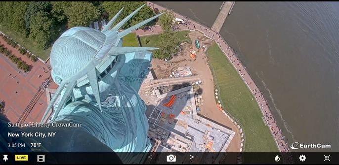
Statue of Liberty National Monument today. Learn more at https://www.nps.gov/stli/index.htm and #nps #nationalparks #photography #landscapephotography #publiclands #interpretation #newtopographics #newyork #statueofliberty #earthcam Image credit National Park Service and EarthCam
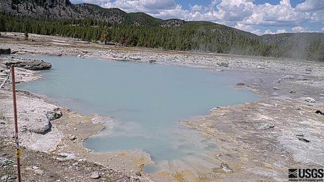
New camera in Yellowstone National Park: Black Diamond Pool, Biscuit Basin (Installed May 14, 2025). Learn more at https://www.usgs.gov/observatories/yvo/news/a-new-view-biscuit-basin-literally and https://www.usgs.gov/media/webcams/biscuit-basin-webcam and https://www.nps.gov/yell/index.htm and #nps #nationalparks #photography #landscapephotography #publiclands #interpretation #yellowstone #geyser #research #usgs #volcano Image credit U.S. Geological Survey/Yellowstone Volcano Observatory
Glacier National Park today (Lake McDonald from Apgar Mountain). For more information https://www.nps.gov/glac/index.htm and https://www.nps.gov/glac/planyourvisit/hikinglakemcdonald.htm and #glacier #interpretation #nps #nationalparks #publiclands #landscapephotography #photography #montana Image credit National Park Service and the Glacier National Park Conservancy #mtwx #spring #snow #lakemcdonald #reflection #trees #mountains #lake #colors #trail #lookout #hiking
Glacier National Park web camera view of Lake McDonald. For more information https://www.nps.gov/glac/index.htm and #glacier #interpretation #nps #nationalparks #publiclands #landscapephotography #photography #montana Image credit National Park Service and the Glacier National Park Conservancy #mtwx #spring #snow #lakemcdonald #reflection #trees #mountains #lake #colors #boat
Rafael Nadal, his three languages, and the lack of interpreters at tennis tournaments. #111Words #RafaelNadal #Tennis #RolandGarros #Multilingualism #Translation #Interpretation https://andrewjshields.blogspot.com/2025/05/rafael-nadal-his-three-languages-and.html
Beautiful day in Yosemite National Park with a week of clear/sunny weather in the forecast. For more information https://www.nps.gov/yose/index.htm and https://www.nps.gov/yose/planyourvisit/weathermap.htm and https://yosemite.org/ and #interpretation #nps #nationalparks #publiclands #landscapephotography #photography Image credit Yosemite Conservancy and National Park Service #yosemite #cawx #spring #trees #halfdome #california #sun #leaves #forecast
Live from Hawaii Volcanoes National Park this morning. Image credit USGS/USGS Hawaiian Volcano Observatory. Learn more at https://www.usgs.gov/volcanoes/kilauea/volcano-updates and https://www.nps.gov/havo/learn/photosmultimedia/webcams.htm and #nps #nationalparks #interpretation #geology #usgs #publiclands #photography #landscapephotography #hawaii #volcano #eruption #kilauea #research #live #lava
Whiskeytown National Recreation Area today. For more information https://www.nps.gov/whis/index.htm and #newtopographics #interpretation #nps #nationalparks #publiclands #landscapephotography #photography #california Image credit National Park Service with support from Whiskeytown Sailing Club and the Friends of Whiskeytown #whiskeytown #trees #cawx #lake
And coast to coast...
Point Reyes National Seashore and Boston National Historical Park today.
Learn more at https://www.nps.gov/pore/index.htm and https://www.nps.gov/bost/index.htm and #nps #nationalparks #ocean #publiclands #photography #landscapephotography #pointreyes Image credit National Park Service Air Quality Web Camera Network and National Park Service and #california #lighthouse #clouds #research #airquality #interpretation #boston #bostonharbor #flag #newtopographics #massachusetts #history
From border to border...
Isle Royale National Park (Mott Island) and Padre Island National Seashore ( Malaquite Beach) today.
For more information https://www.nps.gov/isro/index.htm and https://www.nps.gov/pais/index.htm and #interpretation #nps #nationalparks #publiclands #landscapephotography #photography Image credit National Park Service #IsleRoyale #miwx #lake #spring #michigan #vessel #transportation #texas #seashore #nationalseashore #txwx #padreisland
Lake Meredith National Recreation Area today (View from the Sanford Dam). For more information https://www.nps.gov/lamr/index.htm #newtopographics #interpretation #nps #nationalparks #publiclands #landscapephotography #photography #texas Image credit National Park Service #txwx #clouds #soil
Glacier National Park today (Logan Pass). For more information https://www.nps.gov/glac/index.htm and #glacier #interpretation #nps #nationalparks #publiclands #landscapephotography #photography #montana Image credit National Park Service and the Glacier National Park Conservancy #mtwx #spring #snow #loganpass #trees #mountain
Florissant Fossil Beds National Monument today (“Journey back 34 million years ago, to an Ancient Redwood Forest...”). For more information https://www.nps.gov/flfo/index.htm and #interpretation #nps #nationalparks #publiclands #landscapephotography #photography #colorado Image credit National Park Service #spring #forest #redwood #nationalmonument #FlorissantFossilBedsNationalMonument #infrastructure
Yosemite National Park today. For more information https://www.nps.gov/yose/index.htm and https://www.nps.gov/yose/planyourvisit/weathermap.htm and https://yosemite.org/ and #interpretation #nps #nationalparks #publiclands #landscapephotography #photography Image credit Yosemite Conservancy and National Park Service #yosemite #cawx #spring #trees #yosemitefalls #california #sun #leaves
Glacier National Park today (Lake McDonald). For more information https://www.nps.gov/glac/index.htm and #glacier #interpretation #nps #nationalparks #publiclands #landscapephotography #photography #montana Image credit National Park Service and the Glacier National Park Conservancy #mtwx #spring #lake #reflection

