
#CAwx #LOX #graphicast
Monsoonal moisture will be a risk of thunderstorms to the area over the weekend, especially to the mountains.

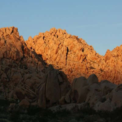
#lox
2 posts1 participant0 posts today
#CAwx #LOX #graphicast
Suggested Actions
Limit outdoor activities to just the early morning hours
Stay in air conditioned spaces during the afternoon and evening hours
Check in on loved ones
Never leave children in a unattended vehicles
Take frequent rest breaks and stay hydrated
#CAwx #LOX #graphicast
A tsunami capable of producing strong currents that may be hazardous to swimmers, boats, and coastal structures is expected. Widespread inundation is NOT expected. However, localized damage at the harbors will be possible. Surging water in and out of harbors can cause boats and docks to detach from structures. Port San Luis including Avila Beach will be of
particular concern for these impacts. If you are located in
#CAwx #LOX #graphicast
Unseasonably hot weather will affect the area today and Thursday, with highs in the 90s to 105 degrees away from the coast, and 70-80 degrees along the beaches. There will also be elevated to brief critical fire danger through early next week over the interior and SW Santa Barbara County.
Continued thread
"267
FXUS66 KLOX 081254
AFDLOX
Area Forecast Discussion...UPDATED
National Weather Service Los Angeles/Oxnard CA
554 AM PDT Tue Jul 8 2025
.SYNOPSIS...07/812 PM.
Temperatures will begin noticeable warming trend on Tuesday. The
heat spell will peak on Wednesday and Thursday, with many areas 5
to 10 degrees above normal. Some cooling is expected by the
weekend, followed by another warming trend early next week.
&&
.SHORT TERM (TDY-THU)...08/346 AM.
High confidence in a significant warm up through Wednesday with
continued well above normal temperatures focused away from the
coast through Thursday. The warm up is attributed to a rapidly
building ridge from the east through Wednesday and offshore trends
from the north during this period as well. High temperatures will
likely peak around 70 right at the coast to near 90 warmer
interior coastal areas such as Los Angeles, while warmer valleys
will see highs 95 to 105+. T"
https://forecast.weather.gov/product.php?site=lox&issuedby=LOX&product=AFD
forecast.weather.govNational Weather Service
Continued thread
Apparently NWS LOX has been destaffed... No heat warnings in our area, no graphics, nothing, to back this news story. NWS San Diego seems to be better.

This funny Jewish saying Live Laugh Lox is a perfect gift for anyone Jewish, or anyone who loves bagels and loves smoked salmon!
#BuyIntoArt #Bagels #Schmear #Lox #Jewish #JewishHumor #JewishGifts #SmokedSalmon#LiveLaughLove
Buy here, only $14.98: https://a.co/d/fqYTpn3
#CAwx #LOX #graphicast
High temperatures will remain very warm away from the coast through at least Tuesday, and likely through late in the week. Highs of 90-102 will be common across the interior, with 80s to lower 90s for southern Santa Barbara County.
#CAwx #LOX #graphicast
A long period southerly swell will continue across the coastal waters through Tuesday. Elevated surf of 3 to 6 feet can be expected at south-facing beaches. Additionally, there will be an increased potential of significant and dangerous rip currents. If headed to the beach, only swim at beaches with lifeguards. Also, stay off rocks and jetties.

Making Liquid Oxygen: Far From Easy but Worth the Effort - Normally, videos over at The Signal Path channel on YouTube have a certain vibe, n... - https://hackaday.com/2025/04/09/making-liquid-oxygen-far-from-easy-but-worth-the-effort/ #pressureswingadsorption #chemistryhacks #concentrator #liquidoxygen #cryocooler #cryogenic #stirling #oxygen #lox #psa
Hackaday · Making Liquid Oxygen: Far From Easy But Worth The EffortNormally, videos over at The Signal Path channel on YouTube have a certain vibe, namely teardowns and deep dives into high-end test equipment for the microwave realm. And while we always love to se…
#CAwx #LOX #graphicast
Potential Impacts:
Wet roads for afternoon commute.
Low but non-zero risk for minor flooding/debris flows
Dangerous lightning for outdoor activities
Area Forecast Discussion...UPDATED
National Weather Service Los Angeles/Oxnard CA
334 AM PST Sat Mar 8 2025
.SYNOPSIS...08/207 AM.
Dry and warmer weather is expected this weekend. Cloudier and cooler conditions are expected next week as a series of storms will bring more rain and mountain snow to the region.
&&
.SHORT TERM (TDY-TUE)...08/305 AM.
Two very nice days on tap this weekend. A ridge over the state
will bring 576 dam hgts to the area. Weak offshore flow this
morning will bring locally gusty northeast winds to many areas but nothing of advisory concern. After a very cool week there will be 3 to 6 locally 8 degrees of warming across the csts/vlys and even greater warming across the interior.
forecast.weather.govNational Weather Service
#CAwx #LOX #graphicast
Northwest winds of 25 to 35 mph with gusts up to 50 mph are expected in the Santa Barbara County Southwestern Coast and Santa Ynez
Mountains Western Range from 6 PM Wednesday evening to 6 AM Thursday. Gale conditions are expected over the coastal waters with northwest winds 20 to 30 kt with gusts up to 35 kt, and combined seas 6 to 11 ft until 3 AM PDT Friday.
NWS Los Angeles:
"Well above normal temperatures are expected through early next
week, especially across the interior areas, with some cooling
expected closer to the coast as onshore flow increases.
Temperatures across the mountains and far interior areas will be dangerously high, and heat illness will pose a threat to anyone in those locations through early next week. Night and morning low clouds and areas of dense fog will continue near the coast."
#heatwave #LOX #NWSLosAngeles #CAwx https://www.weather.gov/wrh/TextProduct?product=afdlox
www.weather.govText Product Viewer
NWS Los Angeles:
"Area Forecast Discussion
National Weather Service Los Angeles/Oxnard CA
1018 AM PDT Thu Jul 18 2024
.SYNOPSIS...18/927 AM.
A significant heatwave will impact Southern California Friday
into next week. A large portion of the mountains, foothills, and
valleys away from the coast will experience dangerously hot
conditions, and very warm conditions may extend toward the coast.
Gusty Sundowner winds will affect portions of southern Santa
Barbara County through Saturday night. Monsoonal moisture will
potentially bring thunderstorms to the interior mountains and
valleys each afternoon into next week."
#heatwave #LosAngeles #CAwx #LOX
https://mesonet.agron.iastate.edu/wx/afos/p.php?pil=AFDLOX&e=202407181718
mesonet.agron.iastate.eduIEM :: AFD from NWS LOXAFD issued by NWS LOX at 18 Jul 2024 17:18 UTC

Satisfied a craving today brought on by a post from @blogdiva - my favorite once in a while breakfast, bagel with cream cheese and lox from the local bagel shop. Soooo good.
From NWS Los Angeles:
"Southwest California continues to be mired in a deep marine layer
and strong onshore flow pattern as a result of persistent troughing along the West Coast. While not atypical to have low clouds in May and June, this year does seem to be a little more gloomy than usual. The trough is expected to start loosening its grip Sunday into next week that will bring about a warming trend, especially by Tuesday, with the main focus being the deserts and other areas far removed from the still chilly influence of the Pacific Ocean. "
https://mesonet.agron.iastate.edu/wx/afos/p.php?pil=AFDLOX&e=202406012309
mesonet.agron.iastate.eduIEM :: AFD from NWS LOXAFD issued by NWS LOX at 01 Jun 2024 23:09 UTC
#CAwx #LOX #graphicast
A low pressure system will bring cooler temperatures, some gusty winds, and light rain or drizzle to the area this this afternoon through early Sunday. Rain chances start for the Central Coast this afternoon, and tonight for Ventura and LA Counties. Highest rainfall totals will be focused on San Luis Obispo and the mountains, with minimal impacts expected for LA City. Winds will also be gusty in areas, especially f
NWS Los Angeles: Good afternoon!!!
Still expecting an impressive storm to impact #SoCal through Tue. Here is a look at the probability of excessive rainfall for Sunday and Sunday night from @NWSWPC
.
A high risk of excessive rainfall for parts of #SantaBarbara and #Ventura counties. #CZwxn
"...SIGNIFICANT THREAT OF WIDESPREAD AND LIFE-THREATENING FLASH
FLOODING SUNDAY INTO MONDAY...
..the most likely outcome for rain totals through Monday are still
3-6" for coast and valleys and 6-12 inches for the foothills and
mountains. The higher end totals are still expected to be from
southern Santa Barbara County to western Ventura County where
60-80kt of south wind will generate a huge orographic enhancement on the south facing mountains.... Flooding issues will not be confined to just the foothills, mountains, and burn ares. ALL AREAS, INCLUDING HIGHLY POPULATED
URBAN AREAS, WILL BE AT RISK FOR LIFE-THREATENING FLOODING.:"
#CAwx #LOX #flooding #rain
https://forecast.weather.gov/product.php?site=LOX&issuedby=LOX&product=AFD&format=CI&version=1&glossary=1
forecast.weather.govNational Weather Service