Blue Rag Range Track, VIC
In this post: Blue Rag Range Track near Dargo in Victoria, Australia: the track, the views, and our route to get there.
This is the blog of Mark Wordsworm, the travelling worm. I’m a 40-year-old bookmark (give or take a few years) and I proudly boast my own Hallmark serial number, 95 HBM 80-1. You’ll probably want to read all about me and my Travelling Companion (the TC).
Today’s travel notes
Me and the TC recently spent a week and a half in the Victorian High Country, a landscape of mountains and valleys in the state of Victoria, Australia. On 23 February, we tackled a bucket-list four-wheel driving track in the area: Blue Rag Range Track.
The book I’m in
Lathe of Heaven by Ursula K Le Guin. Every time this worm gets into a book by this author, I’m astounded at the cleanness of her style and the smartness of her plots. This book is no exception.
Recommended accommodation
Hinnomunjie Bridge campground in Omeo Valley, Victoria. The site is well laid out on the banks of the Mitta Mitta river, with clean toilets and clear grassy areas to pitch your tent.
Recommended restaurant
Dargo Hotel in Dargo.
Travel tips
Try to avoid pitching your tent on a slope. The TC, bless her cotton socks, kept waking up with her feet hanging over the end of the bed and a big empty space at the top of the bed. She finally worked out that she was sliding down thanks to the slope.
The photos
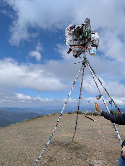
Me at the trig point at the top of Blue Rag Range Track (elevation 1,700 metres / 5,580 feet):
Observant readers will notice the trophies stuck to the trig tower, by people who’re proud to make it to the top. We didn’t leave a trophy, but it is indeed a great feeling to have made this trip.
Observant readers will also notice that it was windy up there! This worm strikes a jaunty pose nonetheless, with my tassel horizontal and a firm grasp from a friendly hand.
Hyper-observant readers will notice Peg skulking in the book at bottom right. Peg makes occasional appearances in my posts, her firm grip on reality keeping me grounded. But even Peg wasn’t strong enough for the gale at the Blue Rag Range trig point.
The track
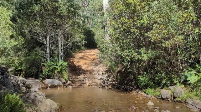
It took us three and a half hours (12:30pm to 4pm) to drive the track itself, with a one-hour lunch break and stops for photographs.
At the start of the track is a steep mound with a hole at its crest, ready to trap the unwary vehicle. Most people choose to go round:
https://youtu.be/1QTcw-_lkZk
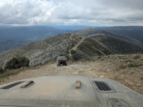
Another video shows the approach to the trig point at the top of the track:
https://youtu.be/jVQ8oNtN2cg
Friendly locals in Dargo told us that it’s unwise to venture beyond the trig point. Those who do will almost certainly need help recovering their vehicles, and the Dargo police are inundated with calls for help from drivers who don’t realise the risks.
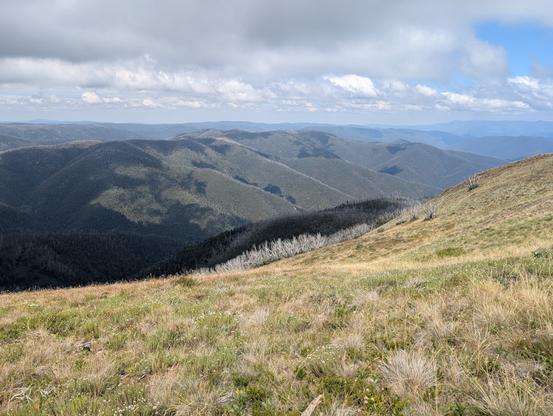
The views from the track are stunning, with mountain ranges all round:
Much of the track runs along the top of the ridge:
A sign post marks the track part-way along, surrounded by white tree skeletons and scrubby grass:
Our route
We started the day by fuelling up in Dargo. This is one of the cars in our convoy:
The Dargo Hotel offers a good feed. Here’s Beetle the Jeep, lined up and ready to go:
We left Dargo in mid-morning, following Lind Avenue along the banks of the Dargo River, then Dargo High Plains Road to the start of the track.
A sign post shows the start of the Blue Rag Range Track on Dargo High Plains Road:
After reaching the Blue Rag Range trig point, we turned round and went back to Dargo High Plains Road, continuing north to the B500.
We camped overnight at Hinnomunjie Bridge campground on the banks of the Mitta Mitta river in Omeo Valley. This beautiful fire barrel was made by one of our travelling companions:
That’s all for today, folks


