Recent searches
Search options

#severewx
0 posts0 participants0 posts today


ABC News: 20 dead as significant severe weather, flash flooding tear through parts of US https://abcnews.go.com/US/significant-severe-weather-flash-flooding-continue-impacting-south/story?id=120519101 #SevereWx #flooding #tornadoes
ABC News · 20 dead as significant severe weather, flash flooding tear through parts of US

Various rivers are forecast to set new records for water height during the ongoing flooding.
Colored dots on the map are streamgages.
Red = moderate flood
Purple = major flood
For a near real time graph, click/tap a dot and follow the link.
To search for a town or address click/tap Menu > Search.
#SevereWx #Flood #Flooding


The Storm Prediction Center issues Day 1 Convective Outlook (Max Risk: Moderate) at Apr 6, 0:56z
https://www.spc.noaa.gov/products/outlook/archive/2025/day1otlk_20250406_0100.html
www.spc.noaa.govStorm Prediction Center Apr 6, 2025 0100 UTC Day 1 Convective OutlookSevere weather, tornado, thunderstorm, fire weather,
storm report, tornado watch, severe thunderstorm watch,
mesoscale discussion, convective outlook products from the Storm
Prediction Center.


Missed this much earlier today, but (as you might imagine) FedEx had delays today. (Friday)
Which really, really sucks if you are getting frozen food on a Friday (speaking from experience in the past)... and they delay it until a Monday.


Storm Prediction Center issues Mesoscale Discussion #393 concerning SEVERE POTENTIAL...TORNADO WATCH LIKELY [watch prob: 95%] [Most Prob: Tornado: 120-150 MPH, Hail: 2.00-3.50 IN, Gust: 55-70 MPH]
www.spc.noaa.govStorm Prediction Center Mesoscale Discussion 393Severe weather, tornado, thunderstorm, fire weather,
storm report, tornado watch, severe thunderstorm watch,
mesoscale discussion, convective outlook products from the Storm
Prediction Center.
Storm Prediction Center cancels Weather Watch Number 112
www.spc.noaa.govStorm Prediction Center Severe Thunderstorm Watch 112Severe weather, tornado, thunderstorm, fire weather,
storm report, tornado watch, severe thunderstorm watch,
mesoscale discussion, convective outlook products from the Storm
Prediction Center.
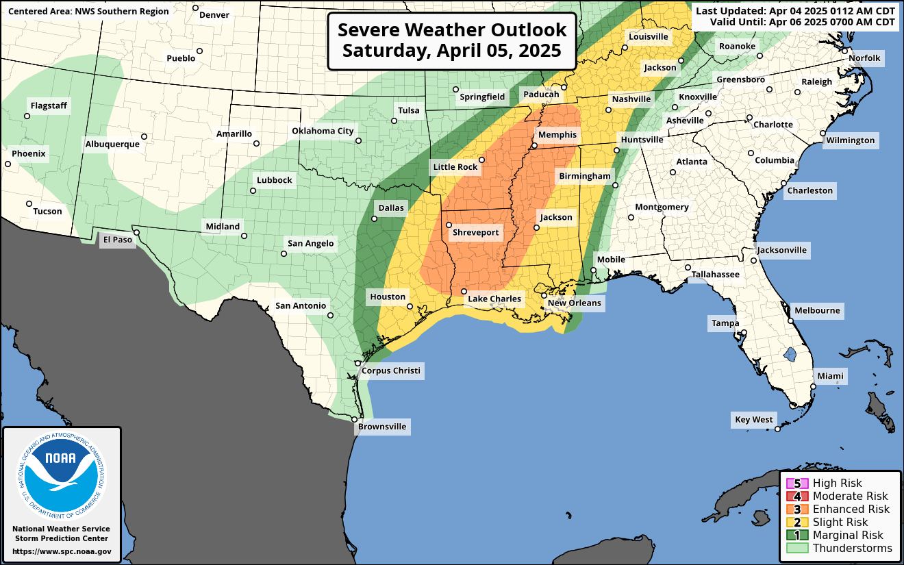
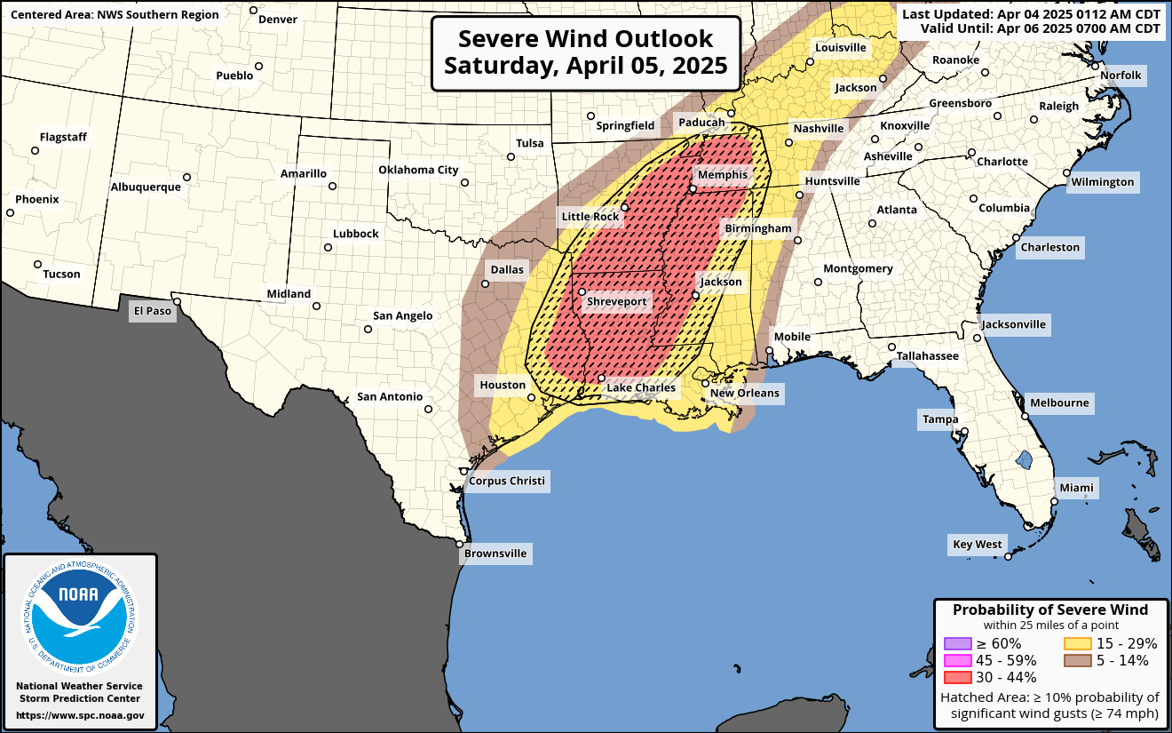
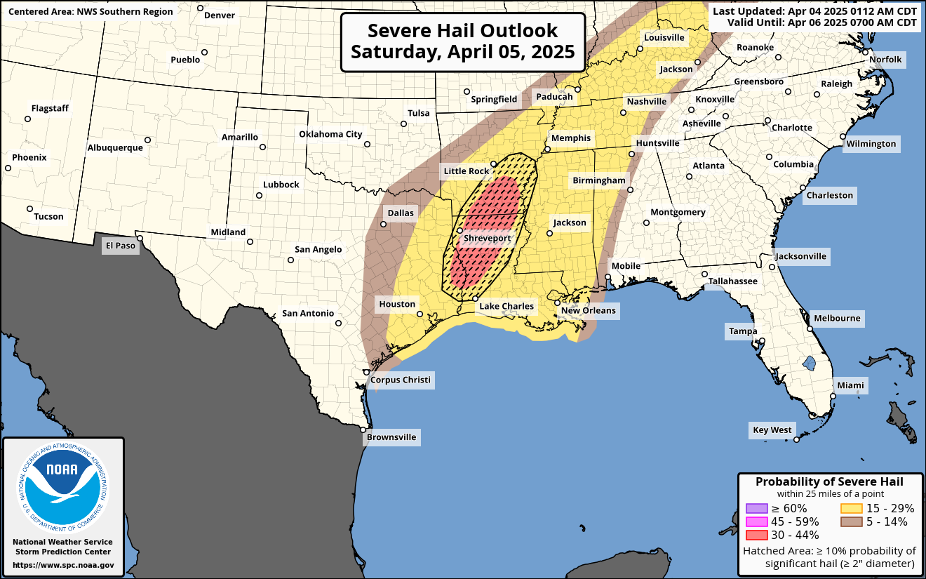
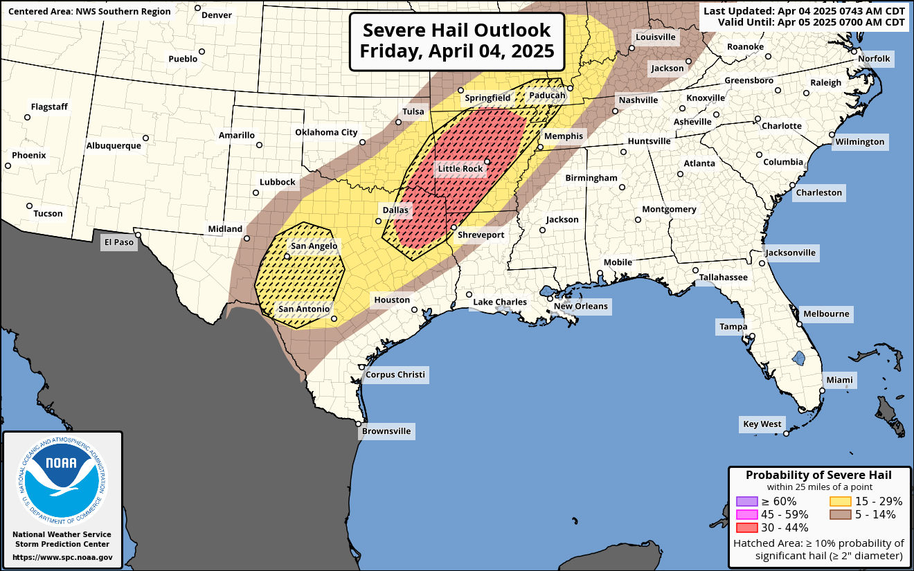
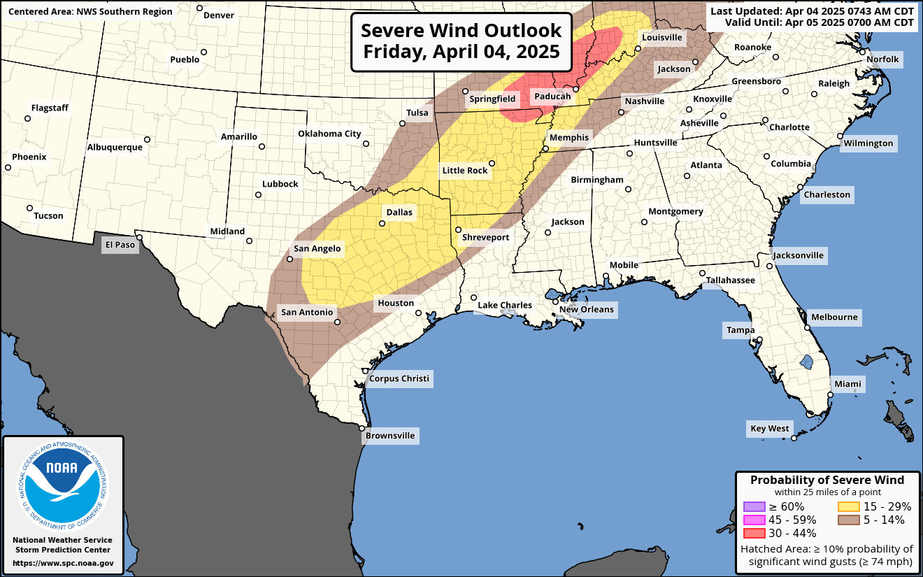
Significant severe weather is possible tomorrow with the possibility of a few tornadoes, some of which could be strong, scattered significant hail, and scattered significant damaging wind gusts. #wx #wxmastodon #mastodonwx #weather #severewx #storms
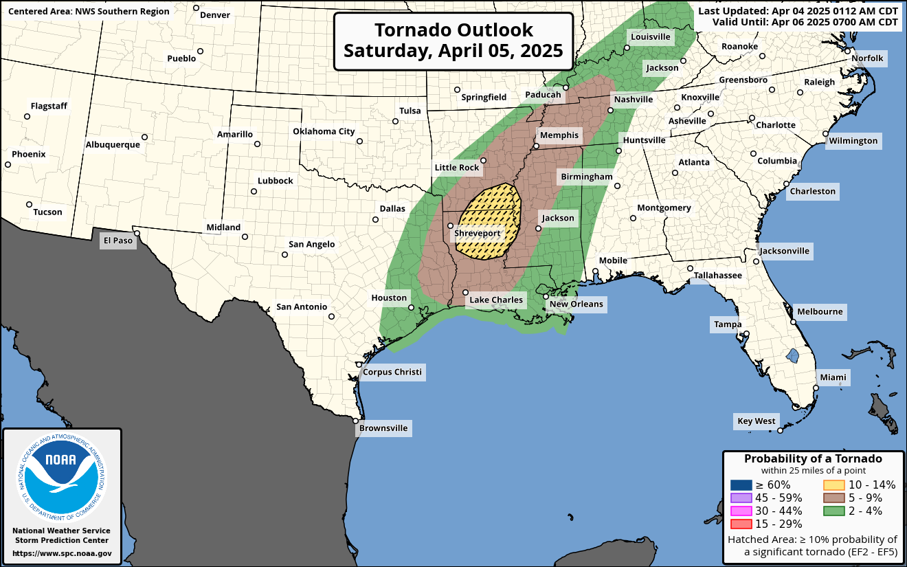
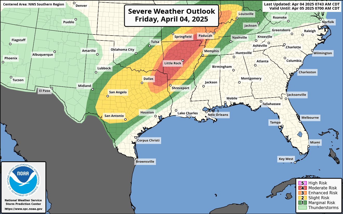
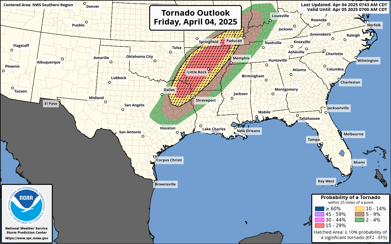
A tornado outbreak may be possible today across the ArkLaTex region with severe storms harboring multiple tornadoes, some of which could be strong to violent, scattered to widespread damaging winds, and scattered significant hail.#wx #weather #wxmastodon #mastodonwx #severewx
Dark red areas on the map are a #FlashFloodWarning.
For details from NOAA open the map, click colored area, follow the link. Since the spot you clicked might have more than one type of weather watch/warning, scroll down in the popup since each type of watch or warning has its own link for the details.
#SevereWx #KYwx #WVwx #Flood
Open #GISsurfer map:
https://mappingsupport.com/p2/gissurfer.php?center=37.656996,-85.979013&zoom=6&basemap=USA_basemap&overlay=State_boundary,USA_weather_radar,Weather_watch_warning&data=https://mappingsupport.com/p2/special_maps/disaster/USA_weather.txt

SPC issues Severe Thunderstorm Watch 112 till 16:00Z
www.spc.noaa.govStorm Prediction Center Severe Thunderstorm Watch 112Severe weather, tornado, thunderstorm, fire weather,
storm report, tornado watch, severe thunderstorm watch,
mesoscale discussion, convective outlook products from the Storm
Prediction Center.
Storm Prediction Center issues Mesoscale Discussion #384 concerning TORNADO WATCH 107...109 [Most Prob: Tornado: 100-130 MPH, Hail: 1.50-2.50 IN, Gust: 55-70 MPH]
www.spc.noaa.govStorm Prediction Center Mesoscale Discussion 384Severe weather, tornado, thunderstorm, fire weather,
storm report, tornado watch, severe thunderstorm watch,
mesoscale discussion, convective outlook products from the Storm
Prediction Center.

The Storm Prediction Center issues Day 3-8 Fire Weather Outlook at Apr 3, 21:34z
https://www.spc.noaa.gov/products/exper/fire_wx/2025/250405.html