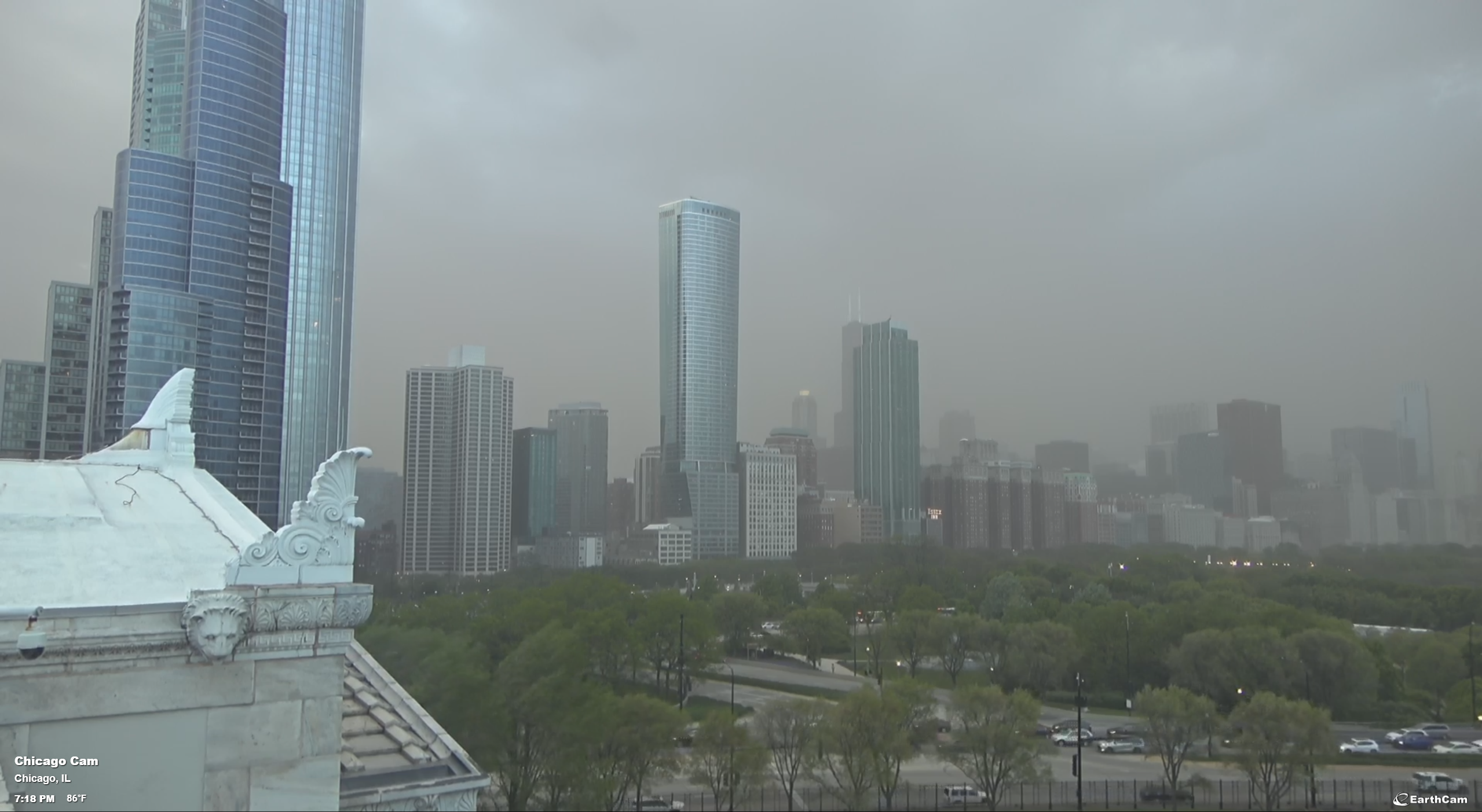
The dust storm in Chicago yesterday was wild. Here's a time lapsed video of it crawling across the city
youtu.be- YouTubeEnjoy the videos and music you love, upload original content, and share it all with friends, family, and the world on YouTube.

The dust storm in Chicago yesterday was wild. Here's a time lapsed video of it crawling across the city
Downtown Chicago is experiencing reduced visibility due to a Dust Storm this evening. Use caution while driving!
PHOTO: EarthCam
Forest fires in Arizona leave smoke plumes in this weather satellite loop for 15 May.
Near the end of the loop, shortly before sunset, you can also see dust from White Sands streaming to the northeast...but it's far less than recent dust storms.
Yesterday's dust storm that was over southern New Mexico is now over the Ark-LA-Tex and parts of Oklahoma. (I have encircled the densest part of the dust storm in red dots.)
This is a follow up to:
https://universeodon.com/@KrajciTom/114504095583613773

Today's (Tuesday, 13 May) dust storm development over the southwest US was extensive.
This visible light weather satellite loop shows several things:
- The worst part of the dust storm developed over southern New Mexico, extreme west Texas (El Paso), and extreme northern Chihuahua, Mexico.
- High winds were quite widespread, and as the sun angle gets low just before sunset you can see dust being kicked up over the northeast corner of Arizona, southern California, and northern Baja California, Mexico.
- The Greer fire in east Arizona, close to the New Mexico state line, is very active and grows quickly with an obvious smoke plume. After sunset, the very end of the satellite loop switches to infrared, and a large black dot (heat signature) replaces the smoke plume.
https://app.watchduty.org/i/48507
This is a follow up to
https://universeodon.com/@KrajciTom/114502610383486085
https://universeodon.com/@KrajciTom/114503132123414456
The dust-storm visibility in Alamogordo, New Mexico remains horrible, with winds gusting up to 58Kts/55Mph/90Km per hour. (Visibility 1/4 mile)
See screen shot for recent METAR reports. Note that the automated weather system says it's raining. That is incorrect. Temperature is 31C and dewpoint is negative 3C...very dry. But all the wind driven dust is confusing the automated weather sensors.
This is a follow up to:
https://universeodon.com/@KrajciTom/114502610383486085

Where did yesterday's dust storm end up?
This weather satellite image at sunrise today shows a brownish plume that extends up to parts of Nebraska, Iowa, etc. (I surrounded the dusty plume with green dots.)
This is a follow up to:
https://universeodon.com/@KrajciTom/114413002689880165

Yet another dust storm over the southeast half of New Mexico, far west Texas, the Texas panhandle, Oklahoma panhandle, extending into Colorado and Kansas.
The dust is coming from prehistoric lake beds in northern Chihuahua, Mexico:
https://en.wikipedia.org/wiki/Lake_Palomas
"Presently its basin is a major source of airborne dust in the region."
With the severe drought conditions in this region, it takes far weaker winds to create these dust storms compared to previous decades. Visibility at my house is less than 1/2 mile.
Note that the dust is tan, but that the gypsum dust from White Sands is paler. A fire is burning in northeast Sonora, Mexico...the smoke plume is bluish. A fire develops in central New Mexico (Rio Grande valley, town of Socorro) at the end of the animation loop. https://app.watchduty.org/i/47153
Wow, major dust storm visible on satellite in southern NM today. Stay off the roads, folks! 4/27/25 1823MT #NMwx #duststorm #dust
Wow, serious dust storm in New Mexico (again) 4/27/25 1822MT #duststorm #NMwx

It was a dynamic weather day in New Mexico.
This weather satellite loop shows us a variety of activity:
- overall west-to-east flow of dry air in the western half of New Mexico. This dry air is not very dusty, at least not initially.
- moist air over the eastern half, which tends to be hazier. This haziness is seen best near the end of the loop when the sun angle gets low.
- strong thunderstorms developing along the dry line
- outflows and gust fronts from the storms raising dust and pushing it east against the flow of the dry air
- strong breezes in northeast Sonora, Mexico boost fire activity. The bluish smoke plume becomes visible near the end of the loop. The strong breezes also pick up dust at the end of the loop...colored tan/brown
- the moist air can't push further west because the terrain gets higher.
This is a follow up to an earlier post/toot about the Dry Line weather system:
https://universeodon.com/@KrajciTom/114406001338553756
A dust storm is kicked up by low-level outflow that races ahead of a cold front in southern New Mexico...reaching deep into west Texas and crossing all of southeast New Mexico by sunset.
This is an animation loop from visible light weather satellite images, overlayed with county boundaries and highways.
This is a follow up to:
https://universeodon.com/@KrajciTom/114366800523414859
A localized dust storm is kicked up by low-level outflow that races ahead of a cold front in southern New Mexico.
This is an animation loop from visible light weather satellite images, overlayed with composite radar, 500mb isobars and wind barbs, and county boundaries and highways.
The screengrab is annotated to show the direction of motion and the low-level outflow boundary that kicks up lots of desert dust. (This screengrab is taken from one of the later frames in the animation loop.)
You probably have to watch the loop more than once to see the subtle initial appearance of the low-level outflow boundary and dust...that becomes all too obvious by the end of the animation loop.
[Edit/add: METAR history (final screengrab) for Alamogordo showing how visibility went to hell as the outflow and dust storm moved into the area.


Serious dust storm conditions in New Mexico right now. 4/17/25 2025 #NMwx #duststorm #Haboob

Dust Storms return to Southern New Mexico. 4/17/25 1419 MT #duststorm #NMwx
Dust storm over the Persian Gulf on Sentinel-3 h/t Kosmi on Bsky
#climatemergency #iraq #duststorm #dust

Animated view of dust storms today 4/1/25 in New Mexico and Texas. #NMwx #TXwx #duststorm