Recent searches
Search options

#scwx


#NIFC #wildfires #firewx
NIFC New Or Updated Wildfire Perimeter
Incident Name: Table Rock
Acres: 11468.4 acres
Updated: Mar 29, 2025 21:34 UTC
Source: IRWIN
#TableRockFire #SCwx


#NIFC #wildfires #firewx
NIFC New Or Updated Wildfire Perimeter
Incident Name: Table Rock
Acres: 9499.9 acres
Updated: Mar 28, 2025 18:34 UTC
Source: IRWIN
#TableRockFire #SCwx


I will say that every single article or news story about #wildfires needs to include a map, calling out where the fires are, their names, and current sizes.
Especially in an area like ours right now, where we have a dozen burning in at least 3 states, all impacting us and each other.

Notable on this image is you can see a *lot* of dead trees (in brown) where this fire is burning, those are trees killed by Hurricane Helene. #HurricaneHelene #wildfires #NCwx #SCwx
Table Rock Complex wildfire (North Carolina) via Sentinel-2 satellite on Mar 26 (shortwave infrared, showing heat). #TableRockComplexFire #wildfires #NCwx #SCwx


#SouthCarolina wildfires.
Table Rock Complex fire has burned 8,680 acres.
Persimmon Ridge fire has burned 1,992 acres
When the map opens it displays the historical USGS topo maps. These are seamless scans of the old paper maps USGS stopped publishing years ago.
#SCwx #SCfire #Wildfire


@easwatch #SCwx #EAS #WEA for SC Emergency Management Division of the South Carolina Adjutant General's Office: Greenville and Pickens County Emergency Managements EVACUATE now! Mandatory evacuation for residence in are east of the Greenville watershed, Table Rock Rd, west of River Falls Rd and Wesleyan Camp. Evacuation SHELTER located at Marietta First Baptist Church at 2936 Geer Hwy, Marietta, SC 29661. Evacuation in effect until further notice. Source: 200400,SC Emergency Management
@easwatch #SCwx #EAS #WEA for SC Emergency Management Division of the South Carolina Adjutant General's Office: Greenville and Pickens County Emergency Managements. EVACUATE NOW! Mandatory Evacuation issued for residents in area east of Greenville WaterShed, Table Rock Rd area, west of River Falls Rd and Wesleyan Camp. Wildfire Shelter located at Marietta First Baptist Church located at 2936 Geer Highway, Marietta, SC 29661. Evacuation in effect until further notice. Source: 200400,SC
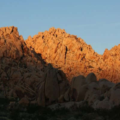
Wildfires in South Carolina.
Interactive GIS wildfire map showing heat detections by the MODIS and VIIRS satellites. This data is not real time and locations are only approximate. Sometimes this data is ‘false positive’.
When the map opens it shows the Table Rock Complex fire and Persimmon Ridge fire. These are in Pickens County and Greenville County, S.C.
To get the most benefit from the map see 2 links in upper left corner.
#SCwx #SCfire #Wildfire
Edit to add the map link:
Open GISsurfer map:
https://mappingsupport.com/p2/gissurfer.php?center=35.066110,-82.670746&zoom=12&basemap=Open_Topo_Map&overlay=VIIRS_7_day,MODIS_7_day,State_boundary,Wildland_fire_name&data=https://mappingsupport.com/p2/special_maps/disaster/USA_wildland_fire.txt


From AP.com: Wildfires prompt evacuations and an emergency declaration in the Carolinas
https://apnews.com/article/north-carolina-wildfires-f28fcfcf1f8acb5761121024766e1384
