Continued thread
ps. if you want to see where there will be future mudflow from the #LineFire 

ps. if you want to see where there will be future mudflow from the #LineFire
@easwatch #LineFire #CAwx #EAS #WEA for 09/29/24 Angelus Oaks EVAC WARNING: Per San Bernardino Co Sheriff: There is a Fire in your area. On Sunday, September 29, 2024, the community of Angelus Oaks is now under an evacuation WARNING. Those who require additional time to evacuate, and those with pets and livestock should leave now. Source: CARiversideSanBernardinoCountiesLECC ** DO NOT RELY ON THIS FEED FOR LIFE SAFETY, SEEK OUT OFFICIAL SOURCES ***
Morning status of Fires followed by BakersRelay. Note: Info may be several hours old.
#RailRidgeFire ACRES 164,158 CONTAINMENT 61%
#WhiskyCreekFire ACRES 3,203 CONTAIN. 25%
#WilliamsMineFire ACRES 13,092 CONTAIN. 32%
Fires no longer relayed by BakersRelay except for community messaging.
#BridgeFire ACRES 54,878 CONTAINMENT 91%
#AirportFire ACRES 23,526 CONTAINMENT 88%
#LineFire ACRES 39,232 CONTAINMENT 80%
#BuckCreekFire ACRES 5,717 CONTAIN. 96%
Morning status of fires relayed by BakersRelay. Note: info can be several hours old.
#BridgeFire ACRES 54,878 CONTAINMENT 79%
#LineFire ACRES 39,232 CONTAINMENT 75%
#RailRidgeFire ACRES 162,994 CONTAIN. 59%
#WhiskyCreekFire ACRES 3,203 CONTAIN. 25%
#WilliamsMineFire ACRES 13,092 CONTAIN. 32%
Fires no longer relayed by BakersRelay except for community messaging.
#AirportFire ACRES 23,519 CONTAINMENT 81%
#BuckCreekFire ACRES 5,703 CONTAIN. 92%
Morning status of fires followed by BakersRelay. Note: Info may be several hours old.
#BridgeFire ACRES 54,877 CONTAINMENT 71%
#AirportFire ACRES 23,519 CONTAINMENT 81%
#LineFire ACRES 39,232 CONTAINMENT 67%
#BuckCreekFire ACRES 5,682 CONTAINMENT 88%
#RailRidgeFire ACRES 162,630 CONTAIN. 56%
#WhiskyCreekFire ACRES 3,169 CONTAIN. 25%
#WilliamsMineFire ACRES 13,092 CONTAIN. 32%
Morning status of fires followed by BakersRelay. Note: info can be several hours old.
#BridgeFire ACRES 54,795 CONTAINMENT 59%
#AirportFire ACRES 23,519 CONTAINMENT 62%
#LineFire ACRES 39,232 CONTAINMENT 57%
#BuckCreekFire ACRES 5,660 CONTAINMENT 66%
#RailRidgeFire ACRES 162,345 CONTAIN. 50%
#WhiskyCreekFire ACRES 3,151 CONTAIN. 25%
#WilliamsMineFire ACRES 13,092 CONTAIN. 31%
Liam Winstead, Staff Reporter
Sep 20 at 5:08 PM EDT
The remaining evacuation warnings have been lifted. This includes the following areas (Zones in parentheses):
Running Springs south of Highway 330/18 (RSP03, RSP04)
Boulder Bay area of Big Bear from the dam east to Wildrose Lane (BBC08)
For exact parameters, see the Watch Duty map and/or the San Bernardino County Evacuation Map. https://sbcounty.maps.arcgis.com/apps/webappviewer/index.html?id=35f8f75a490f4007bc983b39c208a629
Information per multiple Wireless Emergency Alerts sent by the San Bernardino County Sheriff.
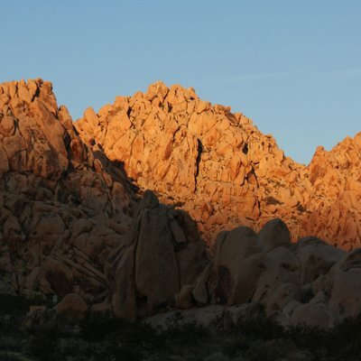
Line Fire @ Base Line Street & Aplin Street, Highland - #LineFire https://share.watchduty.org/i/33389
Morning status of fires followed by BakersRelay. Note: info may be several hours old.
#BridgeFire ACRES 54,795 CONTAINMENT 53%
#AirportFire ACRES 23,519 CONTAINMENT 42%
#LineFire ACRES 39,232 CONTAINMENT 52%
#BuckCreekFire ACRES 5,657 CONTAINMENT 48%
#RailRidgeFire ACRES 162,345 CONTAIN. 50%
#WhiskyCreekFire ACRES 3,145 CONTAIN. 25%
#WilliamsMineFire ACRES 13,092 CONTAIN. 31%
Fires no longer relayed by BakersRelay except for community messaging
#CoffeePotFire ACRES 14,104 CONTAINMENT 93%
#PioneerFire Not actively updated for 11 days
En asociación con agencias locales, estatales y organizaciones no lucrativas, la Oficina de Servicios de Emergencia del Gobernador de California (Cal OES) ha habilitado varios Centro de Asistencia Local (LAC) para ayudar a todos los afectados por los incendios forestales registrados durante las primeras semanas de septiembre del 2024.
Los Centros de Asistencia Local son habilitados para ayudar a los sobrevivientes y empresas que sufren pérdidas o daños relacionados durante un desastre.
#LineFire #BridgeFire #AirportFire #wildfires #disasters #incendios #incendiosforestales
https://news.caloes.ca.gov/a-local-assistance-center-opens-in-riverside-county/
Local Assistance Centers for the Early September 2024 Fires
CalOES in partnership with state, local and non-profit groups, the California Governor’s Office of Emergency Services (Cal OES) opens Local Assistance Centers (LAC) for those impacted by the early September 2024 wildfires.
LACs are activated following disasters to support survivors and businesses experiencing disaster-related losses or damages.
https://news.caloes.ca.gov/a-local-assistance-center-opens-in-riverside-county/
Morning Status of fires followed by BakersRelay. Note: info may be several hours old.
#BridgeFire ACRES 54,795 CONTAINMENT 41%
#AirportFire ACRES 23,519 CONTAINMENT 39%
#LineFire ACRES 39,181 CONTAINMENT 51%
#CoffeePotFire ACRES 14,099 CONTAIN. 87%
#BuckCreekFire ACRES 5,657 CONTAINMENT 38%
#RailRidgeFire ACRES 162,345 CONTAIN. 50%
#WhiskyCreekFire ACRES 3,145 CONTAIN. 25%
#WilliamsMineFire ACRES 13,092 CONTAIN. 31%
#PioneerFire ACRES 38,735 CONTAINMENT 23% (fire info 10 days old)
#LineFire
2/2
Warm weather over the weekend is expected to bring down the vegetation moisture levels which could lead to increased fire activity. Firefighters are strengthening control lines and mopping up hot spots.
An updated Smoke Outlook was published Wednesday. It can be found at fire.airnow.gov
There have been multiple drone incursions over the Line Fire area. This impedes our firefighting operations and can have deadly consequences. Please be respectful of those fighting the fire and the community members who are impacted by fire. Never fly drones near wildfire. If you fly, we can't.
Line Fire @ Base Line Street & Aplin Street, Highland - #LineFire https://share.watchduty.org/i/33389
Michael Silvester, Staff Reporter
Sep 18 at 10:08 PM EDT
Evening update from CAL FIRE: The fire is 39,181 acres & 51% contained.
Situation Summary update: There was minimal fire activity on the Line Fire Wednesday. Most of the smoke & growth occurred in the Bear Creek and Santa Ana River drainages. Temps were below normal, & humidity was higher which increased the moisture in the vegetation. Tonight, partly cloudy and cool conditions are expected across the lower elevations of the fire area.
There is a slight chance of showers over the fire area THU, & a slight chance of showers & thunderstorms FRI. FRI could also bring gusty outflow winds if thunderstorms develop.
@easwatch #LineFire #CAwx #EAS #WEA for 091824 Line Fire Minnelusa Warning Lift: This is the San Bernardino County Sheriffs Department with an important message. On Wednesday, September 18, 2024, at 2:00 pm, the evacuation warning for the community of Minnelusa has been lifted. Please drive safe. Emergency personnel are still actively working in the area. Be cautious and obey all traffic laws. Source: CARiversideSanBernardinoCountiesLECC ** DO NOT RELY ON THIS FEED FOR LIFE SAFETY, SEEK OUT OFFICIAL SOURCES ***
@easwatch #LineFire #CAwx #EAS #WEA for 091824 Line Fire Green Valley Lake Warning Lift: This is the San Bernardino County Sheriffs Department with an important message. On Wednesday, September 18, 2024, at 2:00 pm the evacuation warnings for the community of Green Valley Lake have been lifted. Please drive safe. Emergency personnel are still actively working in the area. Be cautious and obey all traffic laws. Source: CARiversideSanBernardinoCountiesLECC ** DO NOT RELY ON THIS FEED FOR LIFE SAFETY, SEEK OUT OFFICIAL SOU
@easwatch #LineFire #CAwx #EAS #WEA for 091824 Line Fire Seven Oaks Warning Lift: This is the San Bernardino County Sheriffs Department with an important message. On Wednesday, September 18, 2024, at 2:00 pm the evacuation warnings for the community of Seven Oaks have been lifted. Please drive safe. Emergency personnel are still actively working in the area. Be cautious and obey all traffic laws. Source: CARiversideSanBernardinoCountiesLECC ** DO NOT RELY ON THIS FEED FOR LIFE SAFETY, SEEK OUT OFFICIAL SOURCES ***
#LineFire
2/2
There have been multiple drone incursions over the incident area. This impedes our firefighting operations and can have deadly consequences. Please be respectful of those fighting the fire and the community members who are impacted by fire. Never fly drones near wildfire. "If you fly, we can't."
There are evacuation warnings in place. An interactive map is available on the Line Fire Inciweb page.
The San Bernardino National Forest does have a emergency closure order in place for areas affected by this incident. Please visit https://www.fs.usda.gov/sbnf to get more information on this order...