#BOX #MAwx 329
WGUS71 KBOX 121940
FFSBOX
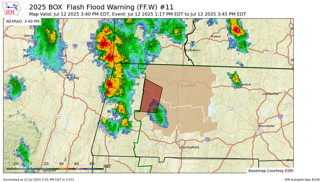
Flash Flood Statement
National Weather Service Boston/Norton MA
340 PM EDT Sat Jul 12 2025
MAC011-015-121950-
/O.EXP.KBOX.FF.W.0011.000000T0000Z-250712T1945Z/
/00000.0.ER.000000T0000Z.000000T0000Z.000000T0000Z.OO/
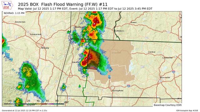
Franklin MA-Hampshire MA-
340 PM EDT Sat Jul 12 2025
...FLASH FLOOD WARNING WILL EXPIRE AT 345 PM EDT THIS AFTERNOON FOR
WEST CENTRAL FRANKLIN AND NORTHWESTERN HAMPSHIRE COUNTIES...
The heavy rain has ended. Flood https://mesonet.agron.iastate.edu/vtec/f/2025-O-EXP-KBOX-FF-W-0011_2025-07-12T19:40Z
Iowa Environmental MesonetKBOX Flash Flood Warning #11Franklin, Hampshire